• Home
  • About
  • Privacy & Disclosure Policy
    • Cookie Policy (EU)
    • Product Reviews & Advertising
  • Blogroll
  • We Recommend…
  • Archives
  • Contact

Snapshot Chronicles Roadtrip

Family travel through a slightly twisted lens. Sense of humor required. Shoes optional.

Bison and Elks and Bears! Oh My!

July 15, 2009 by Mary Cardwell

As we packed up our Montana campsite, our host told us of a spectacular drive through the mountains to Yellowstone National Park, our next destination.  He spoke of Red Lodge and winding roads up the Rockies for views unlike any other that would take us to the Northeast Entrance of the park.  He did warn us to drive carefully because of the high number of deaths on that road each year. 
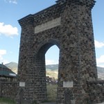
Welcome to Yellowstone

Welcome to Yellowstone

With our adventurous ways tamed just a bit after our last excursion, we followed Betty’s advice and took the safe, boring highway to the North entrance instead.  The ride to the park may have been average but all that changed once we crossed through the gates of the world’s first National Park.

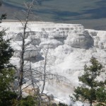
Mammoth springs

Mammoth Hot Springs

I was not prepared for the scope of Yellowstone.  I read a lot about the park and the many different geological areas, each offering different experiences but as we climbed through the mountains, I was in awe of the beauty of the changing landscape.  The first area we drove through was Mammoth Hot Springs.  Large white stone, which looked like ice caps on a mountain top, were covered with colorful hot springs, pools and waterfalls.  There is nothing else like this in the park, so if you have the time, it’s worth a stop and look around.  We continued our scenic drive to Canyon Campground for a two day stay.

Canyon Campground was one of the larger campsites Yellowstone had to offer.  We found our spot and settled in.  The boys were ready to set up the tent to sleep outdoors that night until Dennis noticed the bear claw markings on all the trees around us.  It was probably nothing and the Ranger assured us bears don’t frequent that area anymore but…  The kids slept in the camper that night.  I mentioned how I began to relinquish my fashion standards a bit in the last blog.  In Yellowstone, however, I took it to an all time low. 
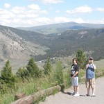
Entering Yellowstone

Entering Yellowstone

I did something that I never thought I would do in my entire life.  Dennis and I are both early risers and in an effort to not wake the kids we decided to go for an early morning walk to get the paper and a coffee.  I went for this mile walk in my pajamas!  Granted, they looked similar to sweatpants but never in my wildest dreams did I ever think I would be in public in PJ’s!  Strange thing is that no one noticed or cared.  More importantly, I wasn’t the only one.

Being uber relaxed, we plotted our day.  A friend of ours had loaned us a book on all the day hikes in Yellowstone.  I found one hike that seemed right up our ally and was only 2 miles from Canyon.  After breakfast, we geared up and head out for an easy, 2-4 mile hike or so we thought. 
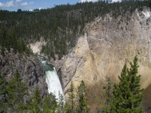
Upper Falls - look closely for the tiny people on the right (spots of colors)

Upper Falls - look closely for the tiny people on the right (spots of colors)

The very first leg of the hike took us from Uncle Tom’s parking area through a trail to Artisians’ Point.  This was a fairly popular walk that brought you into the beginning of the “Grand Canyon of Yellowstone”, where you could see the Upper Falls waterfall and all the tourist on the other side of the canyon.  Once you reached the parking lot at Artisians Point, most folks turned back but thanks to our trusty hike book, we went to the back parking lot and continued our hike.  And oh what a hike it was!
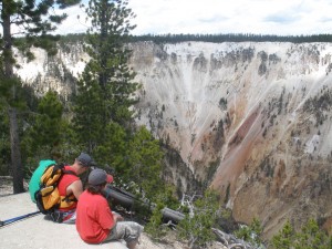
artisans point looking

Taking a breat at Artisians Point

I would not classify the next part of this trail as easy.  We hiked up and up and up and up alongside a cliff, continuing further along the canyon.  The higher we climbed, the more amazing the views.  We saw Bald Eagles swooping over the rocks, canyon walls that look like watercolors dropped from the sky.  Sure we were hot and tired but loving every minute of it, most of us at least.  After hiking to a top elevation of 8100 feet, we saw the trail split back to Clear Lake and Lily Pad Lake where we continued our adventure.    At this point, the boys regretted all the hiking gear we took.  Dennis took on all the gear no one wanted to carry.  Now, the jokes about how it is the jack ass that carries all the gear through the canyon are so obvious I couldn’t resist but I seriously have to say thanks to Den.  
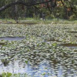
Lily Pad Lake

Lily Pad Lake

We came across Lily Pad Lake where the name was well suited.  With my love of frogs, I moved quickly through this area, the boys on toad alert the whole way.  I made it through without a sighting!  At least 3 miles into the walk so far and no end in sight, we made it to Clear Lake, again properly named. 

We were all so tempted to jump right in and cool off but the idea of walking back in wet shorts wasn’t so appealing.

We all reveled in how our hike brought us up a cliff and then down into the woods that opened into these inviting lakes but imagine our surprise when we rounded the corner to find yet another, completely different landscape.  The next 1/8 mile was several boiling pools of mud.  My skin could have used that treatment, I tell you!  Some were a roaring boil, others were spurts that jumped 3 feet in the air.  It was unlike anything I’ve ever seen.  We would have admired them longer but the smell of sulfur was almost unbearable!  Just like the first time Cam saw the hundreds of bugs that met their fate on the front of our RV, his gag reflex kicked in and we hustled out of there very quickly!

We couldn’t believe we saw three unique geological areas on our single but tiring hike, and then we rounded the next corner to see our final change in landscape – a large open meadow with rolling grass and shady trees.  Pinch me!  I can’t believe this is real. 
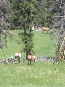
Elks roam free

Elks roam free

As Luke’s hat almost blew off his head again, we all offered to carry it for him because it is now a sacred symbol of our adventures.  As Dennis turned from joking with Luke he stopped dead in his tracks.  An entire herd of Elk were grazing in the field below.  Back in South Dakota, Luke learned the hard way not to yell “Look!  It’s an animal!” when spotting wildlife and we all stood still and watched these beautiful creatures surrounded by nature.  We could see a few Buffalo way off in the distance, thankfully posing absolutely no threat to us. 

After 3 hours and 6+ miles, we spotted our last show stopping site – the parking lot where we started.  We could see the finish line.  I was a little disappointed I didn’t see any bear, from a far of course, but our time in Yellowstone wasn’t done yet.

To see our entire photo album, visit Snapfish.
Filed Under: Cross Country, National/State Park, Wyoming

Central Vermont: Quechee to Stowe

July 11, 2009 by Susan Getgood

Our local adventures this summer are nowhere near as exciting as the Cardwells’ trip west, as we are mostly revisiting favorite places and activities. However, on the theory that some of you will be coming this way for your summer holiday, here’s the rundown on some fun things to do in Central Vermont.

Woodstock

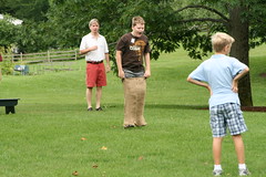
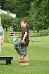
IMG_4996 IMG_4999
A family favorite is Billings Farm in Woodstock. They do a special Independence Day Celebration, including sack races, which Douglas did, and an egg toss (with raw eggs), which he did not.

Be sure to check out Marsh-Billings-Rockefeller National Park while in town.

Where to eat: Bentleys Restaurant downtown. Family friendly, the restaurant just got a new chef who is doing some remarkable things, at reasonable prices.

Word to the wise: Woodstock takes its speed limits and parking regulations VERY SERIOUSLY. Do not exceed the 25 MPH zones on the way in/out of town and remember to feed the meter. If you are in one of the two-hour free spots along Elm Street, don’t exceed the time limit. Park in the free lot instead. A little walk is a lot better than the inevitable parking ticket.

Quechee

QuecheeLegos0012

A fun (and free) activity is Quechee Gorge on Route 4. Wear comfortable shoes, and hike down to the bottom or up to the viewing spot of the dam. Both are very short walks. The state park visitor’s center has public restrooms and there are plenty of options for snacks, sandwiches and ice cream.

Waterbury
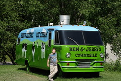
July5Photos0011 July5Photos0003

Waterbury is the home of Ben & Jerry’s. They give a  free ice cream cone on  your birthday, so we decided it was as good a destination as any for mine (the 5th). Turned out, my tour ticket was free as well, so keep that in mind if you are in the area on your birthday. Just tell the cashier when you are buying your tour tickets.

The production line does not run on the weekend, so if you can manage to go on a weekday, it’s worth it.  But they do a decent job on the weekend as well, and no matter when you go, the tour wraps up with a free sample of ice cream.

Mount Mansfield, Stowe

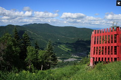
July5Photos0021 July5Photos0014

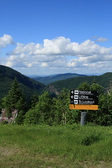
Mount Mansfield is the highest peak in Vermont, and there are a number of ways to enjoy its wonders in the summer months. Last weekend, we drove the Auto Toll Road to the (nearly) top. Cost is $24 per car, hours 9am-4pm (last entry). Other options include an alpine slide and the gondola. Years ago, Dave and I took the gondola one way with two of our dogs and then walked down.

Where to eat: Stowe has some of the best restaurants north of Boston, but if you are looking for something quick and family friendly, try Charlie B’s at the Stoweflake. There’s a nice outdoor deck in the summer months, and board games by the fireplace for the kids if they get restless while you are enjoying your meal.

More pictures from the holiday weekend on Flickr.

—

Thinking of Vermont as a destination? We rent our vacation home at very reasonable rates. Check it out on cyberrentals.

Filed Under: Day Trips, National/State Park, Vermont Tagged With: Ben & Jerry's, Mount Mansfield, Quechee, Stowe, Waterbury, Woodstock

Signs of the West

July 10, 2009 by Mary Cardwell

As our journey continued West, I started to think about all the different ways I could tell we were far away from home

Can't escape

Can't escape

(but there are always a few things that stay the same).  The most obvious differences were the landscape.  Rolling fields that seemed to go on forever.  Cattle and horses were blessed with hundreds of acres to roam and graze.  We laughed every time we saw that one anti-social cow just standing hundreds of yards from the other cows and staring into space.  What on earth could they be thinking about?  

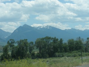
Scenes from Montana

Scenes from Montana

Behind the fields were miles and miles of mountains, some with snow caps visible 150 miles away, others lined with trees that touched the sky.   The scenery was majestic.

I had sort of expected those signs of the west but the ones that took me by surprise were a little closer to home.  First sign that took me back just a bit was when Dennis started to play country music…and I didn’t object.  Typically I would have been tempted to throw something at the radio to make the country twang stop but it actually sounded natural to me. It seemed right.  But the sign that really stopped me in my tracks was when I realized I threw out any sense of fashion and color coordination and traded them for comfort and warmth.   Sorry I don’t have a picture for you but how’s this image – bright orange tank top with olive green fleece, black sweatpants and brown flip flops.  Don’t forget the unkept hair in a ponytail.  What happened to me?  Who was this person?  I’ll tell you who – a very happy and relaxed traveler whose priorities were in the right place!

The most important signs of the West however centered on the Native American Indians.  Towns named after tribes that live in and around the area.   There were signs for Indian reservations that have been here for hundreds of years.  The history and culture of our country’s original inhabitants should be treated with the utmost respect for it was their ancestors who shaped the earliest stories of our nation’s past.  

Battlefield Marker

Battlefield Marker

 As we drove past Crow Agency, an Indian Reservation of the Crow tribe, we noticed the sign for the Battle of Little Bighorn battlefield.  It was an unplanned stop but I insisted we’d only stop for 5 minutes and get right back on the road.    More than thirty minutes later, we drove away with a refreshed interest in our country’s quest to capture the west.

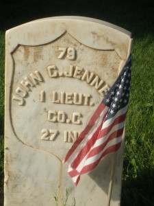
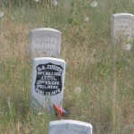
As you pulled into the parking lot, there were hundreds and hundreds of white markers of soldiers who died in the battle.   Some had names and ranks of these loyal men but many were nameless markers of those who never made it home.  A short walk up the hill, you can overlook the actual battlefield littered with markers of men on the spots they had fallen.  

Custer's Marker

Custer's Marker

It was easy to spot the marker of General Custer.  The face of the marker was shaded black to make it distinctive from the others.  Unlike many of the soldiers, Custer’s body was moved to Arlington Cemetery in Washington DC several years back.

My favorite part of the memorial, however, was the story of the American Indians that defeated Custer and his troops.  The memorial was careful not to label the good guy and the bad guy. 

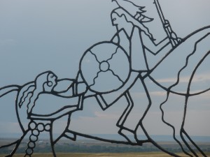
Art sculpture of the battle

Art sculpture of the battle

Many historians believe Custer’s fatal decision to engage in battle was careless and unnecessary.  Others portray him as a great leader.  Whichever side of the fence you fall on, this memorial stays focused on facts and images that make you pause and think.  A must stop for anyone in the area.

As we drove away from the battlefield we had a new perspective on the land we traveled to our campground in Fort Smith Montana which was so small Betty the GPS didn’t know it existed.  When we finally crossed into town lines, the signs proudly told us “Fort Smith, population 311”.   Our campsite was alongside the Bighorn River, beautiful yet buggy.  The owners were so kind, giving us tips on how to enjoy our short time in the area. 

Luke and friends

Luke and friends

Cam's unexpected shower

Cam's unexpected shower

The boys made four new friends, black labs who wore the boys out playing fetch and jumping into the river.    So, as the sun set in the west, we made plans to visit Bighorn National Recreation Area in the morning.  To see our entire photo album, visit Snapfish for Battle of Little Bighorn and Camping in Montana

Filed Under: Cross Country, Montana, National/State Park

« Previous Page

Recent Posts

  • Notice
  • Cityscapes Philadelphia – What To Do, Science & History Geek Edition
  • Cityscapes Philadelphia – What To Do, Art Museum Edition
  • Cityscapes Philadelphia – Where to Eat
  • Cityscapes: San Jose

Search

Categories

Copyright 2009-2018. All Rights Reserved. Photos copyright Susan Getgood unless otherwise noted.

Copyright © 2025 · Lifestyle Pro Theme on Genesis Framework · WordPress · Log in

Manage Cookie Consent
To provide the best experience, we use technologies like cookies to store and/or access device information. Consenting to these technologies will allow us to process data such as browsing behavior or unique IDs on this site. Not consenting or withdrawing consent may adversely affect certain features and functions.
Functional Always active
The technical storage or access is strictly necessary for the legitimate purpose of enabling the use of a specific service explicitly requested by the subscriber or user, or for the sole purpose of carrying out the transmission of a communication over an electronic communications network.
Preferences
The technical storage or access is necessary for the legitimate purpose of storing preferences that are not requested by the subscriber or user.
Statistics
The technical storage or access that is used exclusively for statistical purposes. The technical storage or access that is used exclusively for anonymous statistical purposes. Without a subpoena, voluntary compliance on the part of your Internet Service Provider, or additional records from a third party, information stored or retrieved for this purpose alone cannot usually be used to identify you.
Marketing
The technical storage or access is required to create user profiles to send advertising, or to track the user on a website or across several websites for similar marketing purposes.
Manage options Manage services Manage vendors Read more about these purposes
View preferences
{title} {title} {title}